
Active disaster response

Responding to an event right now? Our team is on call 24/7.

Case Study

South Fork Guadalupe River Flood Monitoring & Early Warning Gage Development

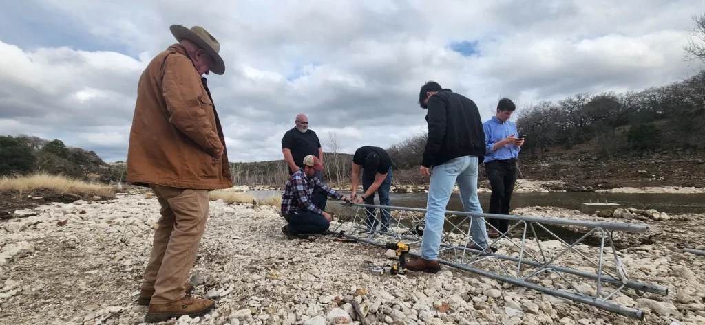
Crew assembling a metal lattice tower for a South Fork Guadalupe River flood monitoring and early warning gage.

Challenge

Following repeated flash flooding across the Guadalupe River Basin, UGRA sought to expand its flood monitoring network with a strategically located gage on the South Fork Guadalupe River. The objective was to maximize advance warning for downstream communities and vulnerable locations by identifying a site capable of providing reliable, real-time flood intelligence while supporting future flood forecasting and emergency response operations.

Our Approach

Streamline evaluated multiple candidate locations using hydrologic and hydraulic analyses, watershed characteristics, field reconnaissance, communication reliability, constructability, and operational considerations. Working closely with UGRA, we identified the optimal gage location, established flood stage thresholds, and developed operational trigger recommendations to maximize warning time while ensuring reliable performance during extreme flood events.

Results & Impact

  • Identified the optimal monitoring location on the South Fork Guadalupe River to maximize downstream warning time.
  • Developed operational flood stage thresholds supporting emergency response decision-making.
  • Improved flood intelligence for vulnerable roadways, low-water crossings, and downstream communities.
  • Established the foundation for future predictive flood forecasting and regional flood warning system expansion.
  • Enhanced community resilience through earlier, more reliable flood detection and real-time situational awareness.

Client

Regional Flood Warning Initiative

Location

South Fork Guadalupe River, Kerr County, Texas

Related Services

  • Flood Early Warning Systems
  • Hydrologic & Hydraulic Modeling
  • Flood Forecasting
  • Real-Time Monitoring Systems
  • Stream Gage Planning & Design
  • Emergency Management Support
  • GIS & Spatial Analytics
  • Sensor Network Planning
  • Operational Decision Support
  • Infrastructure Resilience

Join our network

Is Your Community Ready for What's Next?

Natural disasters don’t wait, and neither should planning. Whether you’re preparing for future flood risks, responding to an emergency, or investing in long-term infrastructure improvements, Streamline provides the expertise communities need for what comes next.

JOIN OUR NETWORK

Working With Streamline Starts With A Conversation

Tell us about your project, challenge, or immediate need, and our team will review the information, connect you with the right expertise, and work with you to define the path forward. From initial planning and scoping through implementation, we focus on clear communication, practical solutions, and getting projects moving.